PLACE
Location
Republic of Côte d'Ivoire
Sector
Disaster Prevention and Preparedness
Type of Investment
Grant
Project Stage
Pilot
Length of Investment
2022+
Investment Overview
PLACE provides detailed, timely mapping data for urban and coastal areas to governments in the developing world at a cheaper price to tackle the impacts of climate change and myriad other urban development challenges.
The Development Challenge
Maps are critical for planning and managing modern economies and improving public infrastructure, yet much of Africa remains unmapped, with only 3% of its landmass covered and 80% of urban development occurring without informed, technological approaches. Urbanisation is accelerating at 20% annually, outpacing resources and staff capacity needed for mapping. Detailed, up-to-date maps are essential for building climate resilience, enabling governments to identify vulnerable populations, plan infrastructure, and manage climate impacts like flooding. This data is often inaccessible in the developing world due to high costs, sporadic donor support and restricted availability. Without public funding, private companies are unlikely to invest in or make such data readily available for public use, leaving many cities in the developing world without the foundational maps needed for effective decision-making.
The Innovation
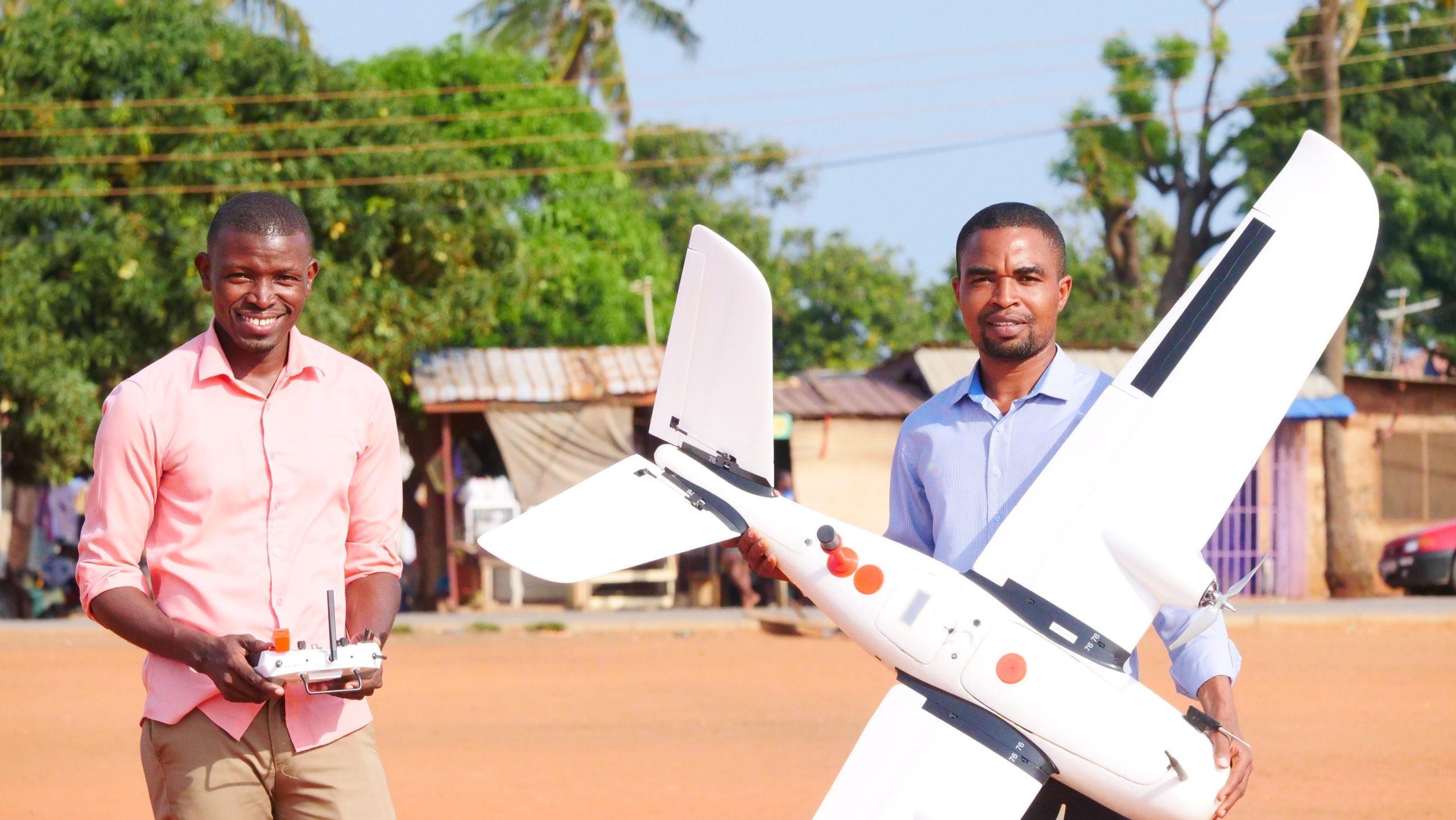
PLACE addresses this market failure through a suite of interconnected innovations that provide detailed, timely mapping data to governments in the developing world at a lower cost. Institutionally, PLACE establishes a data trust that grants governments ownership of mapping data while enabling ethical access for private companies, NGOs and academics. Financially, PLACE employs a sliding payment scale where commercial users fund data collection and can build products on the base maps, while NGOs and researchers pay nominal fees. Technologically, PLACE leverages low-cost, high-performance drones to capture georeferenced imagery with 5cm resolution and 6cm topographical accuracy. In the market, PLACE drives capacity-building and demand by supporting local organisations to operate drones and supply imagery regularly, creating a sustainable ecosystem for high-quality mapping data.
Our Investment
GIF awarded PLACE a $460K grant in March of 2022 to support PLACE in establishing a legal data trust model for data collection in emerging economies, validate this model by mapping two populated urban areas in developing economies and demonstrate the use of the data by government entities and the PLACE Community.
Progress to Date
PLACE has established the PLACE Trust for the collection and storage of mapping data in emerging economies and has generated high quality mapping data from both government partners and members in seven countries in Africa and small island nations.
Formal relationships with governments of critical markets like Nigeria and Malawi signify growing interest in Africa for PLACE’s work.
Governments and partners are now using PLACE data to address flood mitigation, identification of informal settlements, and land valuation and taxation.
PLACE in numbers
Of urban development in Africa is happening without technologically informed approaches
Countries mapped and supported
GIF investment in pilot
Innovating for Climate Resilience
PLACE provides mapping data for urban and coastal areas, strengthening governments' and stakeholders’ climate adaptation and resilience efforts. The non-profit received a $460,000 grant. Ultra-detailed up-to-date digital maps are essential to planning and implementing climate resilience and adaptation for urban areas. Topographic maps accurate to centimetres, rather than metres, that show the current condition of roads and drainage, as well as dwelling density and conditions down to the house level, will be a critical contribution to urban resilience amidst the vast urban expansion already underway.